The mountain stream of St Barthélémy (Evionnaz)
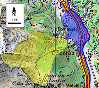
Fig. 1: Topographic Map of the St Barthélémy catchment highlighted in yellow and the fan highlighted in blue (From Swiss map 50).
The debris flows of the St Barthélémy mountain stream are known since Roman time (Eisbacher et Clague, 1984 ; Montandon 1933) (Figs. 1 and 2). Successive catastrophic events are reported in 1636, 1910, 1835, 1926, 1927, 1930, 1970.
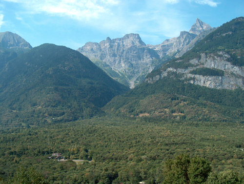
Fig. 2: View of the St Barthélémy forested fan with the gorges and the Cime de l’Est on the background (Peak on the right).
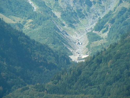
Fig. 3: View of one of the first dams erected in the 1920′ along the channel to avoid bed incision. The talus slope on the left is probably the remains of an old debris cone.
The debris flows during the period from 26 September, 1926 to 9 October, 1926 brought down to the Rhone river approximately 106 m3 of material. More recently (~1995) despite the construction of two concrete dams in 1975 and during the eighties (Fig. 3), a debris flows had partially obstructed the Rhone river. Today maintenance works are currently planed for an amount of 3 Mio Swiss francs.
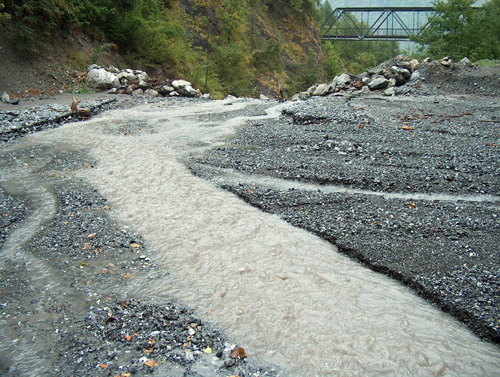
Fig. 4: Present state (17.08.2003) of the riverbed of the St Bathélémy. Note the amount of sediments that are prone to create debris flows.
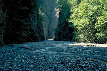
Fig. 4b: View of the deposit within the channel joining the accumulation zone and the fan (Picture E. Bardou).
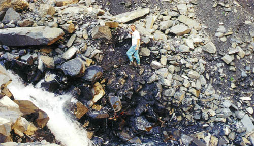
Fig. 4c: A cross-section within a debris flow nicked by the river (Picture E. Bardou).
The factors that enhance the activity of this catchment are most probably linked to:
- Steep slope of the catchment and lower order stream sufficiently flat for debris accumulations (Fig. 4)
- Presence of moraines (Fig. 3)
- The small size of the catchment
- The geological setting that make large rockfalls possible (Fig. 5)
- The geological setting implying high erodability
- The stream is situated at the contact of the gneissic basement and with the helvetic carbonate series.
- Flyschs implying clays minerals occurrence
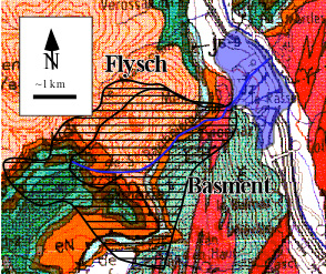
Fig. 5 : Geological map (from BRGM 1 :250’000 ; Map Thonons-les-Bains) of the St Barthélémy catchment (in blue the debris cone).
It must be said that the neighboring catchement of Mauvoisin had not built such an important fan although its settings are similar. Even if the current process of erosion is to be related with bed load transport, it seems that it could be due to a venturi effect of the Rhône before the St-Maurice cluse.
References:
Définition d’une lave torrentielle. CREALP page.
Bardou E. (2002): Méthodologie de diagnostic des laves torrentielles sur un bassin versant alpin. Thèse EPFL.
Eisbacher G.H. & Clague J.J. (1984): Destructive mass movements in high mountains: hazard and management – Geol Soc. of Canada, Paper 84-16, 230 p.
Montandon, F. (1927): Le réveil des Dent du Midi (Coulées de 1926 et de 1927). Le Globe, Genève, 66, 1-15.
Montandon, F. (1930): Les coulées de 1930 au St-Barthélémy (Suisse). Mat. Cal. 6, 25, 239-251.