Erosion processes (gravity slope processes, landslides and river erosion) are controlled by many different factors such as precipitation, snow melt, groundwater circulation, alteration, rock fracturing, sediment mechanical characteristics, earthquakes, freezing effects, weathering, uplift, and anthropic factors on environment.
The principle of Quanterra is to make fundamental research useful for landscape control, planning and management and to freely spread knowledge by publication, report computer programs etc. that state organizations and private companies have no time and money to develop alone.
Short Courses
 |
Caractérisations géométriques simples des discontinuités dans un massif rocheux (in French), 13p. Contenu: Ce fascicule est un recueil de formules simples qui permettent de caractériser les dimensions des discontinuités, illustré par quelques exemples. Il s’inspire directement de l’ouvrage “Distribution spatiale des discontinuités dans une falaise, approche statistique et probabiliste” (Jaboyedoff et al., 1996, Rapport de travail Pnr 31, VDF, 90 p.). Ces notes ont été améliorées par des commentaires constructifs de F. Baillifard (CREALP). |
 |
Questionnaire complémentaire sur l’éboulement de Randa (in French).
By M. Jaboyedoff, dans le cadre de Formation postgrade internationale en géologie de l’ingénieur et de l’environnement 2002-03. 15p. Related sites: geolepwww.epfl.ch, www.crealp.ch |
 |
Identification des versants rocheux potentiellement instables (in French).
By M. Jaboyedoff, F. Baillifard, J.F. Kaufmann et V. Labiouse. Université Européenne d’Eté sur les risques naturels 2002, Sion Suisse. 27p. Related sites: www.risknat.org, www.crealp.ch, lmrwww.epfl.ch Abstract |
Open file reports
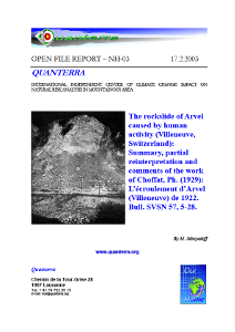 |
The rockslide of Arvel caused by human activity (Villeneuve, Switzerland): Summary, partial reinterpretation and comments of the work of Ph. Choffat (1929): L’écroulement d’Arvel (Villeneuve) de 1922. Bull. SVSN 57, 5-28. (in English). Documents are reproduced with the authorization of the Société Vaudoise des Sciences Naturelles www.unil.ch/svsn/ Abstract: The rock-fall of Arvel occurred within alternating carbonates and marls in a stone quarry. The deposits spread out on the slope and on the horizontal alluvial plain of the Rhône valley. The alluvial sediments were highly disturbed. The unstable rock mass was promoted by unfavorable structures, i.e. joint sets and marls stratum. This bad situation was made worse by excavations made in the quarry. This event, the unfavorable structure, and the recent events demonstrate the erosion sensitivity of this area. The active quarry also favored destabilization. This makes the entire slope a dangerous area. The important economic activities recently developed in the neighborhood of this slope indicates that a careful and constant monitoring of this slope is necessary. |
 |
Visite des gorges du Tarn (1-2 octobre 2002) (in French). Abstract: This note is an overview of the discussions that we had with Sir Pauly (form the CETE d’Aix-en-Provence) during a visit of the “gorge du Tarn” in France. The CETE was I in charge of the mapping of the rock hazard in this area. References: (Pauly, J.-C. and Payany, M. 2002. Méthodologies mises en oeuvre pour la cartographie de l’aléa lié aux instabilités rocheuses sur basin géographique. Le cas des gorges du Tarn et de la Jonte (Lozère). Bull. Lab. Ponts et Chaussées, 236: 37-57.) |
Key publications
-
Detection of Rock instabilities: Matterrock methodology. (in English)
Jaboyedoff M., Marro C., Philippossian F. & Rouiller J.D. (1999). In proceddings of Impact load by falling rock and design of protection structures. Nippo-Swiss seminary Kanazawa. 13-19.
Abstract: In rugged topographies, numerical elevation model allows to detect the most dangerous areas. The simplest method consists in the detection of steep cliffs. In addition, numerical elevation model coupled with a characterisation of the main discontinuity sets leads to the identification of the zones where discontinuities can induce instability, rockfalls or rock slides. Probability of occurrence of dangerous events can be assigned to these zones. Then the zones of highest probability may be subject to more detailed studies such as field work and slope stability calculations. After such a detection stage, impact areas and their hazards can be estimated for example by field work or by trajectography studies that can be used to established danger and hazard maps.
-
Matterock. une méthodologie d’auscultation des falaises et de détection des instabilités rocheuses. (in French)
Baillifard F., Jaboyedoff M., Rouiller, J.-D. et Tosoni, D. (2001). Extrait de : Confrontation des méthodes d’étude des éboulements dans l’arc alpin. Programme Interreg IIC – « Falaises ». Méditerranée occidentale et Alpes latines. 70-83.
Distribué lors de Université Européenne d’Eté sur les risques naturels 2002, Sion Suisse. Related sites: www.crealp.ch and www.risknat.org
Développée par le Centre de Recherche sur l’Environnement ALPin de Sion (CREALP) dans le cadre du Projet National de Recherche helvétique PNR 31 “changements climatiques et catastrophes naturelles”, la méthodologie d’auscultation des falaises Matterock postule qu’il n’y a pas d’instabilités rocheuses sans discontinuités. Elle consiste dans un premier temps à caractériser les discontinuités affectant le massif rocheux, et à visualiser par l’intermédiaire d’un agencement structural les relations géométriques tridimensionnelles qu’elles ont entre elles. La confrontation (visuelle ou informatique) de cet agencement structural et de la topographie locale permet la détection des secteurs instables ou potentiellement instables. Les compartiments ainsi mis en évidence sont ensuite décrits in situ, et un indice qualifiant la probabilité de rupture, dépendant des facteurs intrinsèques à l’instabilité, de sa sensibilité aux processus d’évolution et aux situations déclenchantes, leur est attribué. Finalement une carte de danger, tenant compte de la probabilité de rupture de l’instabilité, de la probabilité d’atteinte et de l’intensité du phénomène en un point donné du territoire est élaborée.