The complex landslide of Yvorne
On 1st March 1584, a rock avalanche detached from the summit of the Tour d’Ai and spread out on the terrace of Luan (Figs. 1 et 2), above the village of Yvorne. This event was followed by two days of heavy rain and snowmelt. The third day the weather improved, but open cracks developed in the rock deposit going with slide downhill over preexisting quaternary deposits.
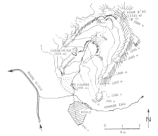
Fig. 1 : Map the rock avalanche and debris flow of Yvorne (from Eisbacher and Clague, 1984)
A debris flow constituted of rock avalanche and Pleistocene deposits of 107 m3 and 600 m wide slide down to Yvorne killing 328 peoples (Figs. 1 et 2). The morphology of the deposit of 1584 can be still observed in the vineyard of Yvorne (Eisbacher et Clague, 1984)
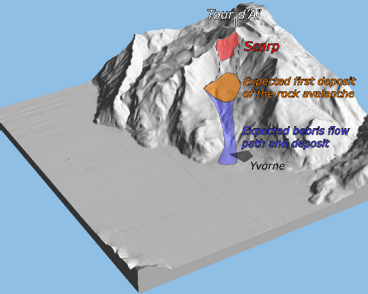
Fig. 2 : 3d illustration of the Yvorne rock fall and debris flow location (topographic background modified from Atlas of Switzerland).
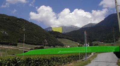
Fig. 3 : In yellow the source area of the rock avalanche. In green the present rest of the debris flow deposit.
References:
Bonnard Ch. (2002) : Eboulements. Dictionnaire Historique de la Suisse.
Eisbacher G.H. & Clague J.J. (1984): Destructive mass movements in high mountains: hazard and management – Geol Soc. of Canada, Paper 84-16, 230 p.