Illgraben
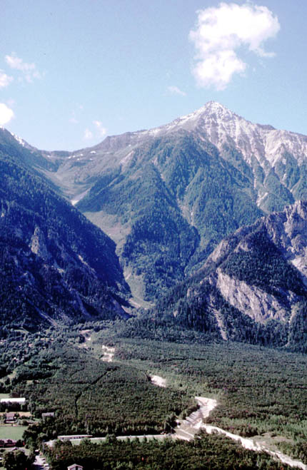
Fig. 1: view of the fan and part of the catchment of l’Illgraben (Picture E. Bardou).
L’Illgraben is an inhabited steep valley on the left bank of the Rhône valley suffering high erosion rate (Fig. 1 and 2). The Illgraben catchment area is constituted of strongly fractured quartzites, evaporities and carbonates. This fracturing is caused by the Rhône-Simplon fault or by one of its digitations still active today.
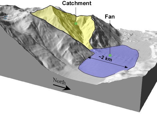
Fig. 2: 3D view of the Illgraben (3D view from Atlas of Switzerland, Swisstopo).
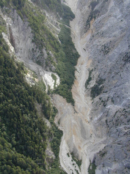
Fig. 3: Picture of the ravined slopes of the catchment of the Illgraben (Picture E. Bardou).
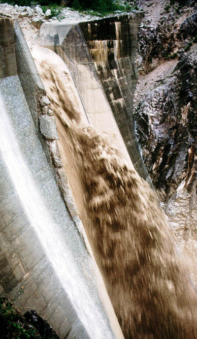
Fig. 4: View of a dam with a recent debris flow (Picture E. Bardou)
The catchment is bare and suffers frequent rockfalls, which supply the material for the debris flows (Fig. 3).
In 1961 3.5 millions m3 of evaporites fell down and spread over the bottom of the valley inducing, 6th June, 1961, a large debris flow that destroyed the Rhône river.
Every year several small debris flows occur in the Illgraben, but they are usually contained by the existing works (check dams).
References:
Bardou E. (2002): Méthodologie de diagnostic des laves torrentielles sur un bassin versant alpin. Thèse EPFL.
Bardou E., Sartori M., Zimmermann M. (in prep.)
Eisbacher G.H. & Clague J.J. (1984): Destructive mass movements in high mountains: hazard and management – Geol Soc. of Canada, Paper 84-16, 230 p.