Rockfall of Leytron and landslide of Montagnon
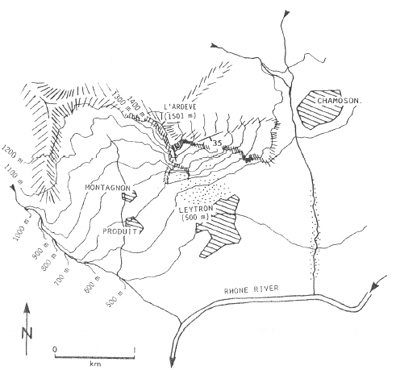
Fig. 1 : Location of the landslide in the Ardève area (from de Eisbacher et Clague, 1984).
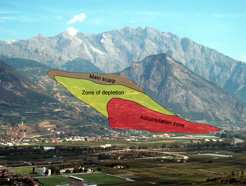
Fig.2: Schematic interpretation of the different elements of the Montagnon Landslide.
In 1570 part of the village of Leytron was destroyed by a rockslide coming from the rock face l’Ardève.
In 1906, 5 to 6 million m3 were involved in a slump above the town of Chamoson causing several debris flows (Fig. 1). The drainage work made at that period permitted to avoid a catastrophe (Eisenbacher and Clague, 1984 ; Montendon, 1933).
In the western part of the Ardève the large landslide of Montagnon can be observed. It involves the entire slope and several hamlets (Fig. 3).
It is located within schist of mid-Jurassic age of the Helvetic nappes. Its thickness can reach 100 m (Fig. 4). The scar is complex and seems controlled by preexisting geological structures.
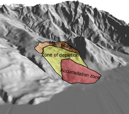
Fig. 3 : 3D view of the landslide of Montagnon. Some structures (faults) can be figured out. They control the morphology (3D view from Atlas of Switzerland, Swisstopo).
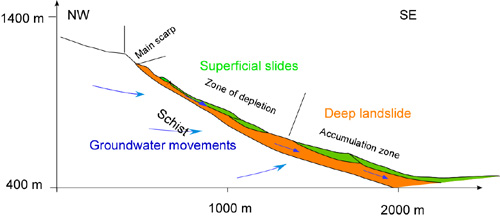
Fig. 4: Cross-section of the Landslide of Matagnon showing the assumed groundwater flow path and the different units of the landslide (After M. Sartori, Crealp).
References:
Bloc diagramme du glissement de Montagon présentant le contexte géologique et hydrogéologique (page of http://www.crealp.ch/).
Eisbacher G.H. & Clague J.J. (1984): Destructive mass movements in high mountains: hazard and management – Geol Soc. of Canada, Paper 84-16, 230 p.